Speaking of trippy views, 73 years ago today, the Swiss chemist Albert Hofmann took LSD for the first time on purpose, having discovered its psychedelic properties by accident three days earlier. (For some Atlantic reading on the subject, check out John N. Bleibtreu’s “LSD and the Third Eye” in our September 1966 issue.)
But Anthony Quigley explains what’s really going on in this satellite view:
When Google Maps and Google Earth came onto the scene, some countries and institutions wanted to block Google from displaying certain places. (These were possibly the same people who thought [the Internet] was a fad!). There are various places around the world that tried this. One such place was The Netherlands, who asked Google to “blur” the images. Today’s photo—taken a few years ago—is a great example of this idiocy at play.
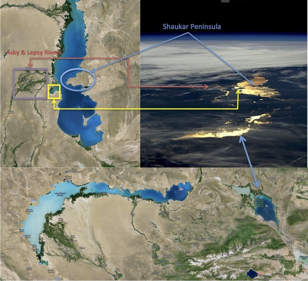
I think we are looking west over Lake Balkhash in Kazakhstan with the UNESCO Alakol Biosphere Reserve in the foreground. The peninsula jutting into the lake form the northern shore is here on Google Maps. Attached is a collage comparing Tim Peake’s picture from the International Space Station to overhead pictures of Lake Balkhash:
It was great to try one of these again. Not as fun as the Dish’s window view contest, but pretty enjoyable.