The Inter-American Highway
From the Panama Canal to the southern border of Mexico, the Inter-American Highway stretches 1600 miles, through some of the most spectacular scenery in the Western Hemisphere. Since 1930 the American government has underwritten the major cost of this six-nation thoroughfare — an investment approaching $250 million, or nearly three quarters of the original cost of the Panama Canal. Now transitable for its entire length (the Mexican section of 1500 additional miles was finished several years ago), the Inter-American Highway ought to beckon to American automobile travelers from every state in the Union.
The six governments — those of Panama and the five Central American republics — are all on record as endorsing turismo. “Drive to sunny Salvador,” they proclaim, “land of eternal spring.” Or Nicaragua, or Honduras, or Guatemala, as the case may be. Captivating brochures are distributed throughout the United States, and the six Isthmian ambassadors will desert Washington at the drop of an invitation, to extol before chambers of commerce from Boston to San Francisco the attractions of their respective countries.
The targets of this amiable propaganda are the American people, a nation of nomads, who each year drive millions of miles and spend millions of dollars searching insatiably for new motels to admire, new horizons to conquer, but they are not admiring the horizons of Central America, even though the InterAmerican Highway is now in good condition — barring the southern half of the Costa Rican section, which remains to be hard-surfaced.
It is not that the inhabitants are churlish or unfriendly. Far from it — most of them are hospitable and cheerful. Nor are their facilities inadequate: hotels in most capitals are comfortable, and overnight accommodations are improving elsewhere. Gasoline is readily available. Prices are not exorbitant.
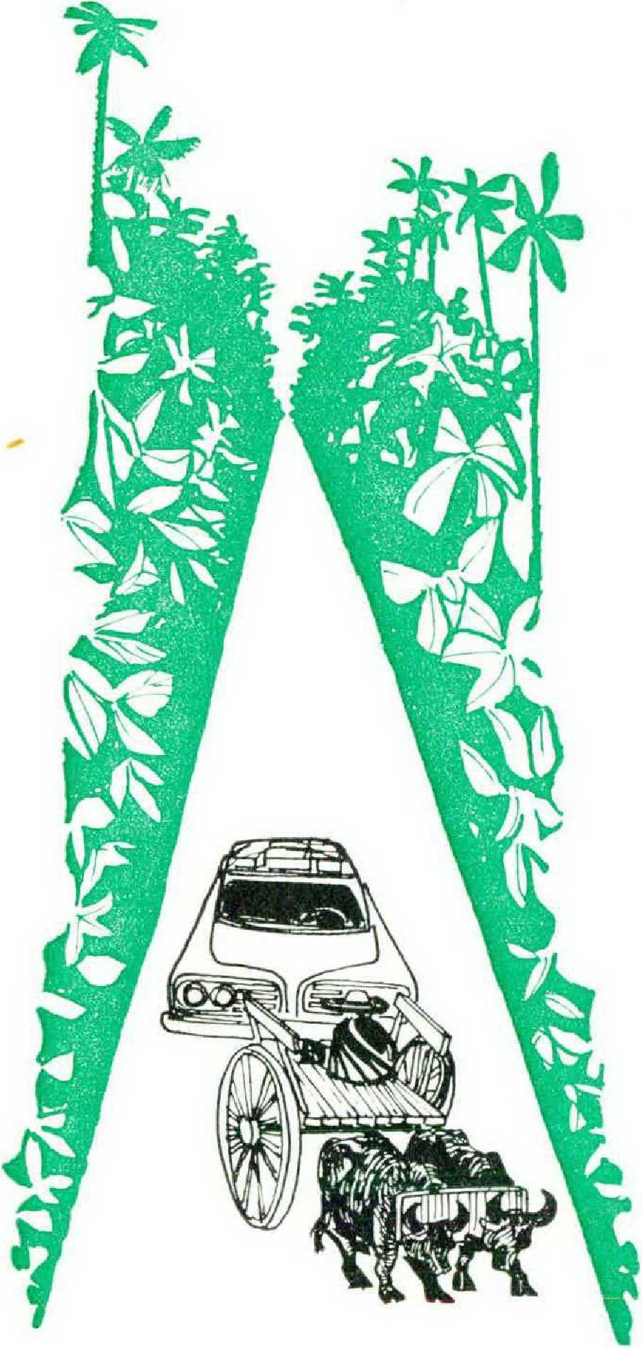
How is it then that the highway, insofar as international traffic goes, is almost deserted? For miles in either direction the road is left to burros, oxcarts, and barefoot participants in weddings in the next village. A local bus or an overloaded truck is seen now and then. But there is practically no international travel.
The answer is Central American bureaucracy, a bureaucracy of such stultifying and paralyzing torpor that it is almost as if the Great Wall of China had been dropped in chunks across the frontier crossings, sealing off each country from the next one.
The American Automobile Association reaches the heart of the matter when it grumbles, “Border crossings present a problem. . . .” They do indeed. And American automobile owners are unwilling to put up with the delays, harassments, restrictions, and bureaucratic lunacies practiced by the frontier guardians of Panama, Costa Rica, Nicaragua, Honduras, El Salvador, and Guatemala.
Counting entry into Panama as the first hurdle, the Inter-American Highway involves thirteen separate border crossings, all of them vexatious and most of them preposterous. To bring an automobile into Panama, arriving by vessel and proposing to depart ten days later via the land frontier with Costa Rica, the owner of the car can be involved in from four to seven days of painful and repetitious negotiations, in as many separate Panamanian government offices as there are copies of the ship’s bill of lading, an archaic document that has done as much to retard international turismo as the inspector’s glue pot or the impression seal.
After one is admitted as a tourist, the business of obtaining permission to depart from a country and to enter the next involves from six to ten separate operations, effected by as many different inspectors and agencies. These may include a special office in the capital, miles away from the border itself, where an exit permit must be obtained in advance of departure. That document is then displayed at the border to representatives of emigration, police, and customs of the country through which one has just traveled. Fifty yards and two flagpoles farther on, a new set of inspectors in a different set of uniforms from the next country is encountered.
Nor is this Central American scrutiny of the stranger either casual or pro forma. It is accomplished with dignity and persistence, and at a snail’s pace. It frequently involves copying, in longhand or on a rachitic typewriter, much of the data appearing on the visitor’s passport, which is thereby lengthened further by notations under the heading salida or entrada, as the case may be.
The automobile and its contents are then inspected, along with the owner’s registration and driving permit, and much of this information is again laboriously transferred to official documentation. Furthermore, the requirements vary from country to country: Nicaragua, for no ascertainable reason, demands five photographs — possibly they send one to J. Edgar Hoover.
Again, Central American border stations are not permanently open for business, or else they are not simultaneously or concurrently open. The far one is likely to close for luncheon, or a siesta, or because in that country it is a local saint’s day, while the traveler next door is still negotiating his exit. In such cases special arrangements can often be made, for a modest additional fee, but involving a further delay.
Of the twelve border stations between Panama and Mexico, all but two (at the Nicaragua-Honduras mountain frontier) are inland and at sea level, and hence among the hottest places in the hemisphere. An automobile joining a line of stalled trucks and buses awaiting inspection quickly becomes an inferno of metal too hot for the ungloved hand to touch.
In order to clear one border and to enter the next requires, on the average, ninety minutes, even with special accreditation accelerating passage. Without that, the delays could extend toward infinity, and probably would. When all of this has finally been accomplished, there is often an additional check, this time by the military of the new country, several miles beyond the border crossing itself. The military require a further stop, further scrutiny of credentials, and a further delay.
There are other obstacles to carefree travel on the Inter-American Highway. Six different currencies are used between the Panama Canal and Mexico. For 1596 miles of highway, that works out to one new country — and a new currency — every 266 miles. Because it is impossible for a traveler to calculate exactly what his cash requirements in a given country may be, he usually has from ten to several hundred dollars’ worth of balboas, colones, cordobas, lempiras, quetzals, or pesos left over. With no exchange facilities at any one of the twelve frontiers, the traveler is often stuck with this currency, which may be rejected within the new borders.
Although the five Central American countries have a customs union (and Panama is an applicant for membership), their skepticism about one another’s products remains. Lines of stalled trucks carrying goods awaiting inspection add to border congestion. And if the automobile traveler is so unfortunate as to reach a frontier just behind a busload of local families, complete with children, babies, furniture, live chickens, and household possessions, his woe is compounded.
Another source of harassment is automobile insurance for the InterAmerican Highway. This protection is essential for the foreign traveler since otherwise, following an accident, the alien driver is likely to be remanded to jail, there to await the outcome of litigation and the final assessment of damages. But American policies are not recognized in Central America, and PanamaCentral American coverage, which in turn is not valid in Mexico, is issued for a full year only, although the insured traveler will usually spend not over two or three months crossing the six countries, and if he is in a hurry, he can accomplish the journey in even a week or ten days. The issuing office will eventually redeem the unused portion, heavily discounted.
Travel by automobile in Central America is thus geared not to the twentieth century but to the days of the oxcart. If passengers by air were subjected to a fraction of the treatment accorded automobile drivers, not a dozen a week would survive to record their impressions. Until the handling of automobile tourists is comparably modernized, it is futile for Central America to advertise the Inter-American Highway; international travelers will simply decline to use it.
The steps that ought to be taken are uncomplicated, and they should be painless to the host countries. The visa requirement should be abolished. The possession of a valid passport, or a readily obtainable tourist card, should suffice to identify the American traveler.
The automobile itself should be covered by a document like the one in use in Europe — a carnet issued by a responsible central authority, the American Automobile Association, for instance. With as many pages as there are frontiers to be crossed, and with each page completed in advance with the specifications of the automobile, one page could be detached at each border and retained by the authorities.
If Central America insists on maintaining the present fly-scourged border posts, to each should be added a special window, reserved for international automobile travelers. And until such time as the common market is buttressed by a common currency, valid in all six jurisdictions, each border station should include an official exchange office, where spare cordobas can be swapped for balboas, without the tourist being swindled.
The exit permit serves no useful purpose, nor does the submission of photographs, and it would not cost the Good Neighbors an extortionate amount (which they could borrow from the United States anyway) to air-condition their frontier premises.
The steamship companies could cooperate by terminating the practice of charging upwards of 75 percent of round-trip transportation for one-way automobile fare, thus encouraging travelers to go one way by sea, instead of driving twice over the same 3000 miles between the Canal Zone and Texas. While the shipping companies are at it, a baggage check should be substituted for the automobile bill of lading, the way the Canadians handle shipments between Maine and Nova Scotia. Any paper as complex as a bill of lading is an irresistible temptation to bureaucracy.
The American Society of Travel Agents could help the reliable AAA toward simplifying arrangements.
Last, the Department of State in Washington, which for more than a generation has supported the efforts of the Bureau of Public Roads to obtain funds to build the InterAmerican Highway, would not only give border simplification its blessing, but instruct American ambassadors in the six Isthmian capitals to collaborate in measures to make such a program effective.
Notwithstanding identity of language, religion, colonial heritage, and bureaucratic nonsense in dealing with tourists-by-automobile, the six countries in other particulars show wide and fascinating divergencies.
Bisected by the Canal Zone, Panama is easily the most Americanized of the six nations. More English is spoken in Panama than in Central America, distances are counted in miles instead of kilometers, American hotels enliven the capital, and familiar billboards plaster Panama City (“Ponga un tigre en su tanque!”).
Four hundred miles of trackless tropical jungle lie between South America and the Canal, so the InterAmerican Highway now starts at Panama City, continuing for 300 miles to the Costa Rican border. (In South America, the international route is called the Pan-American, instead of the Inter-American, Highway.) The route skirts the Pacific littoral, through farming and cattle country, with the ocean on the left and the spine of the continental divide on the east and north. Inland from the town of David, 30 miles from the Costa Rican border, a good road leads off the highway and into the blue-green hills, to one of the most attractive retreats — the village of Boquete, nearly 4000 feet above sea level. Boquete, rather than David, is the place to spend the first night out of Panama City.
There is a catch, however, in Panamanian turismo. Ever since Nasser stole the Suez Canal in 1956, the Panamanian politicians have been obsessed by larcenous thoughts, which often take the form of antiAmerican agitation. To the extent that the American government temporizes, turns the other cheek, or otherwise abets the misbehavior of the local politicos, their prestige is enhanced, and the attraction of Panama for American visitors will be correspondingly reduced.
In Costa Rica the Inter-American Highway is divided into two sections: from the Panama border to Cartago, more than 200 unpaved miles, including an impressive crossing of the continental divide at more than 11,000 feet above the Caribbean and the Pacific, with both oceans visible; and from Cartago via nearby San José to Nicaragua, another 200 paved miles, where lack of maintenance has allowed the surface to deteriorate into potholes and rubble.
Long regarded as the pearl of Caribbean democracy, Costa Rica has dunked its treasures too often in the vinegar of the welfare state. It is today a country of poor whites, perched beside its volcanoes and babbling of deficit spending. Their roads are the worst between Texas and the Darién jungle.
Costa Rica shares with its Central American neighbors standard traffic signs reading, “No deje piedras en el camino,” which may be translated, “Don’t leave stones on the highway.” That refers to the custom of overloading trucks, which often break down on the steep mountain grades; the disabled vehicle is saved from rolling backward by a large rock, manhandled from the ditch into position behind a rear wheel. Ten days and a new transmission later the camión is repaired, once again overloaded, and then driven away from the rock, which remains on the right-of-way, an exceptionally hazardous obstacle to automobile navigation. Elsewhere than in Costa Rica the stone is shoved off the road before the truck departs, but no Costa Rican has been known to move one.
Nicaragua is a cheerful place, full of Indians, mestizos, mulattoes, and whites — tough hombres with get-up-and-go, who keep their highways in excellent condition, including the famous Rama road toward the Caribbean, built by the United States as a consolation prize from President Franklin Roosevelt to President Somoza for not digging a new isthmian canal across Nicaraguan territory.
Along with its prosperous economy and fine highways, Nicaragua has an unattractive capital on the sizzling margin of Lake Managua, with one of the worst hotels in Latin America. The prudent visitor does well to exchange Managua for the flowers and forests above Matagalpa, where the climate is caressing and the scenery something to remember. That was once the country of the United States Marines, where four decades ago they chased the bandit Sandino, while anti-interventionist orators enlivened successive Pan-American meetings by denouncing American imperialism. But in the flower-bedecked uplands of Nicaragua the marines are remembered with affection: order was restored, crops were not only planted but harvested, and the survivors of Saturday nights in Jinotega still refer with pride to the durability of those spirited fiestas.
Next door, Honduras is one of the most unsophisticated of countries, and one of the most attractive. The ancient capital of Tegucigalpa is seventy miles off the Inter-American Highway, but now connected with it by a fine and scenic road. The bells of the Tegucigalpa Cathedral are the loudest between there and Saint Peter’s in Rome, and since the hotel nestles beside the church, few Tegucigalpa tourists sleep beyond 5 A.M., when the first bongknocks plaster off the green and white presidential palace half a mile down the valley.
Honduras, where the terrain is excessively rugged, also boasts a fine if informal air service. Its center is San Pedro Sula, second metropolis of the country, and the thriving international airport is soon to be connected with Tegucigalpa by a highway underwritten by the World Bank. Honduras is a coming country.
Tiny El Salvador, the only country without a Caribbean coastline, boasts the most beautiful capital in Central America, along with a small but cosmopolitan elite, good hotels, gracious living, and an economy precariously tied to exceptionally fragrant coffee.
Beyond Salvador lies Mayan Guatemala, where turismo — by air, not automobile — is already well established. Stupendous volcanoes poke up from the fertile plateau. Reconstructed Antigua, bowing to its viceregal past, does well with modern amenities. Lake Atitlán, home of the vanishing giant grebe, must be seen to be believed. And over the eastern Guatemalan hills, deep in the rain forest, lie the fabulous temples of Tikal, which a decade hence may rival the Sphinx and the Pyramids as tourist attractions.
Thus Central America already has pleasures to set against its tedious border procedures. The InterAmerican Highway does not, of course, have to be traveled north from the Canal Zone, although once the frontiers are tidied up, that is probably the preferred way to cover the route, with the sun always at one’s back. The highway is also accessible via Mexico to Guatemala, with two paved roads leading south from the isthmus and city of Tehuantepec. From Texas to Guatemala is 1500 miles; add another 500 from California via Tijuana.
For those who prefer to drive northbound, freight but not passenger service exists from New York and gulf ports to Puerto Limón, which is the port for San José in Costa Rica, avoiding Panama and the unpaved, rock-strewn stretch from the Panama border to the Costa Rican capital; to La Ceiba and Tela, Honduras, in the heart of the banana empire, whence a passable road leads to Tegucigalpa; and to Puerto Barrios in Guatemala, whence a paved highway leads to Guatemala City.
It is feasible today to ship an automobile to any of these four Caribbean ports, and for the owner to join his car on the dock, having himself flown from the United States via the capital city concerned. Getting there may not be half the fun — as transatlantic advertisements used to proclaim — but getting the car out of the clutches of the aduaneros and off the Central American pier may turn out to be the most arduous part of the trip. The Inter-American Highway, a link in the long route dreamed of a century and a half ago by Bolivár, could thereupon become an artery of international travel and goodwill — a turnpike worthy of the imagination and statesmanship mobilized for its construction.